
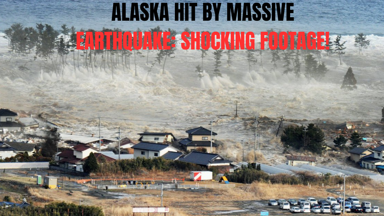
A powerful 7.3-magnitude earthquake struck near Sand Point, Alaska, triggering a tsunami warning. Explore the seismic history, tsunami threats, and why Alaska is a global hotspot for earthquakes.
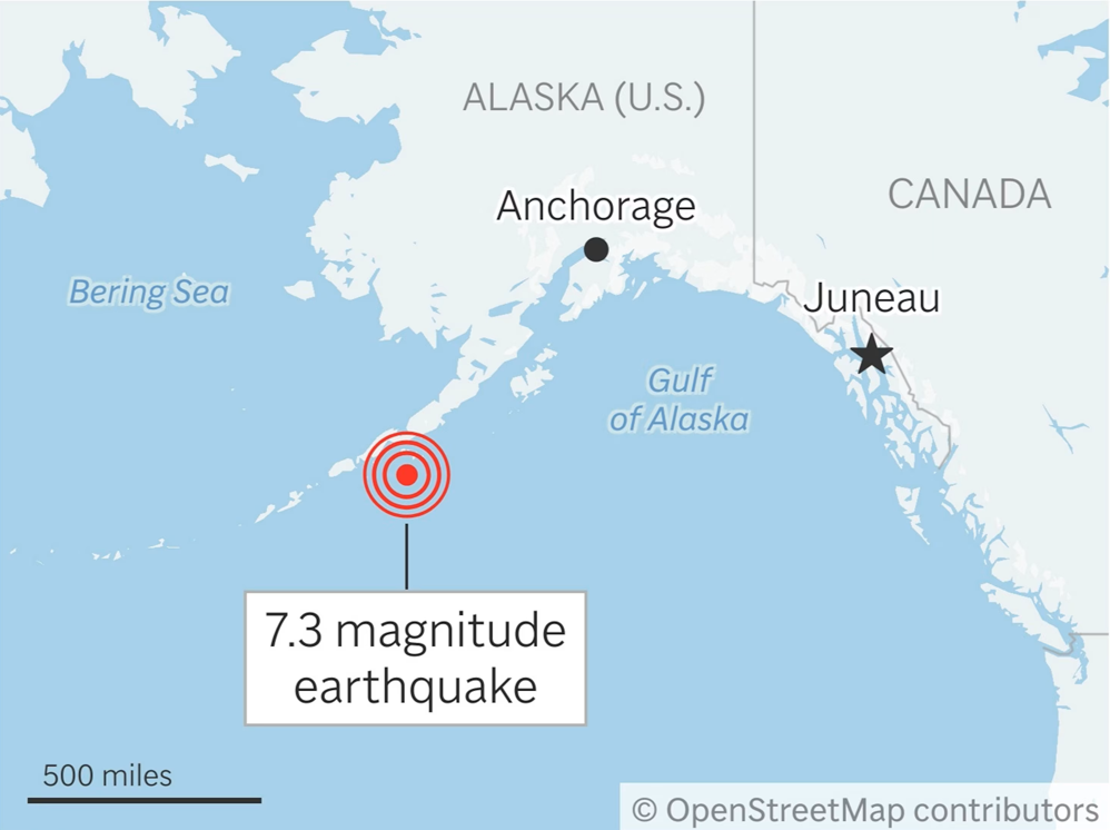
powerful earthquake measuring 7.3 in magnitude struck off the coast of Alaska on Wednesday, drawing global attention and prompting an immediate tsunami warning across the Alaska Peninsula. The quake, confirmed by the US Geological Survey (USGS), occurred at approximately 12:37 p.m. local time (2037 GMT) and sent ripples of concern throughout the seismic community and coastal populations alike.
The Epicenter and Immediate Impact
The tremor’s epicenter was pinpointed about 54 miles (87 kilometers) south of Sand Point, a small island town along Alaska’s southern coastline. The earthquake was relatively shallow, originating at a depth of just 20.1 kilometers beneath the ocean floor, a condition often associated with a higher potential to trigger tsunamis.
Shortly after the quake, the National Weather Service in Anchorage issued a tsunami warning for areas stretching from Kennedy Entrance to Unimak Pass. Communities such as Cold Bay, Kodiak, and Sand Point were urged to stay vigilant. “We can say with reasonable confidence that the Kenai Peninsula Borough locations will not see impacts,” the agency announced on social media platform X (formerly Twitter).
The National Tsunami Warning Center (NTWC) in Palmer, Alaska, added, “Some impacts are expected.” Fortunately, no tsunami alerts were issued beyond the initially specified coastal region.
Alaska’s Volatile Seismic History
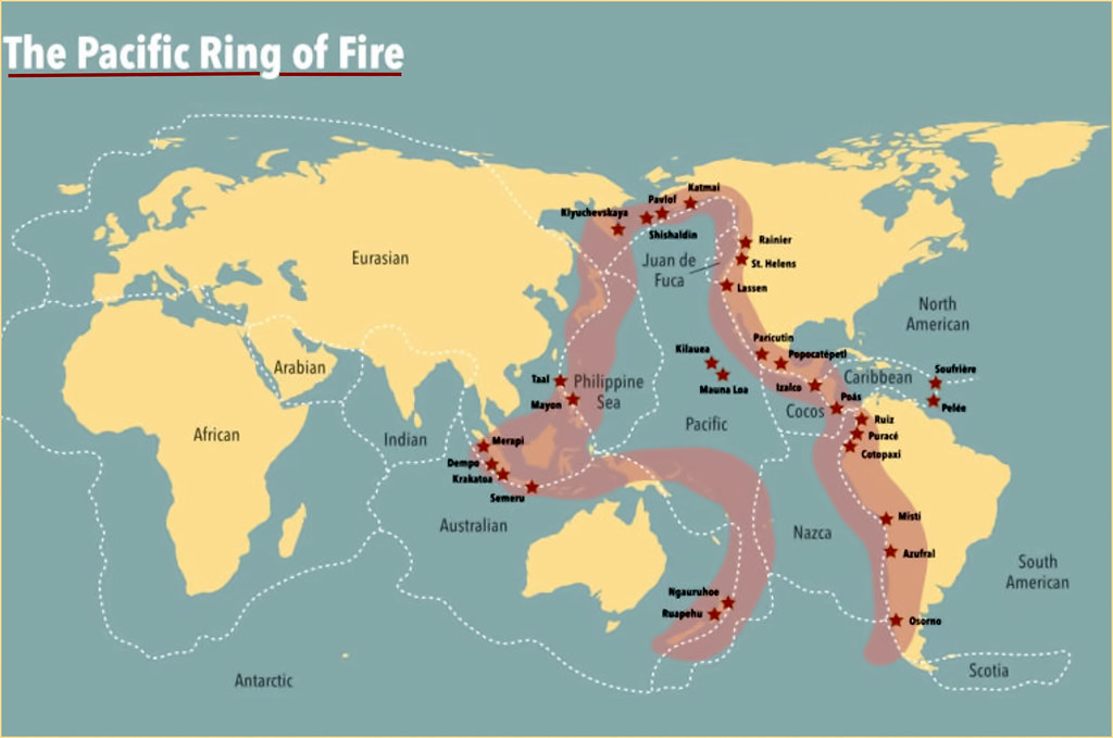
Alaska is no stranger to seismic turmoil. It sits atop the Pacific Ring of Fire—a massive horseshoe-shaped belt known for its frequent earthquakes and volcanic activity. Historically, Alaska has experienced some of the most powerful seismic events ever recorded.
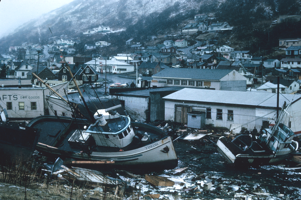
The 1964 Great Alaska Earthquake, which registered at 9.2 magnitude, remains the strongest earthquake ever recorded in North America. That catastrophic event devastated Anchorage and triggered tsunamis that caused destruction throughout the Gulf of Alaska, the U.S. West Coast, and as far as Hawaii, killing more than 250 people.
More recently, in July 2023, a 7.3-magnitude quake also struck the Alaskan Peninsula. While it didn’t cause major damage or result in a tsunami, it highlighted the ongoing vulnerability of the region.
Why is Alaska So Prone to Earthquakes?
The short answer is tectonic activity. Alaska lies directly along the boundary between the Pacific Plate and the North American Plate. This area, particularly the Alaska-Aleutian subduction zone, is where the Pacific Plate is constantly being forced beneath the North American Plate.
This ongoing geological collision creates immense pressure. When that stress is suddenly released, it results in powerful earthquakes. Additionally, Alaska is laced with numerous fault lines, including the Denali Fault, which contribute to its high seismic activity.
The Ring of Fire Connection
The Pacific Ring of Fire is a 40,000-kilometer-long zone that loops around the Pacific Ocean. It’s home to about 90% of the world’s earthquakes and 75% of its active volcanoes. Alaska’s southern coastline is an integral part of this zone.
Subduction zones within the Ring of Fire, where one tectonic plate is forced under another, are hotbeds for seismic and volcanic activity. As these plates grind, collide, and slip past each other, they create the perfect storm for frequent and powerful earthquakes.
What Happens After an Earthquake in Alaska?
When a major quake hits, several systems are activated immediately. Agencies like the USGS and the NTWC assess the earthquake’s magnitude, depth, and location to determine the tsunami potential. In this case, the shallow depth and offshore location near a subduction zone raised red flags.
Modern technology plays a pivotal role. DART (Deep-ocean Assessment and Reporting of Tsunamis) buoys and tide gauges help verify whether a tsunami has been generated. If even a slight sea-level change is observed, alerts are sent out within minutes.
Types of Tsunami Alerts
Understanding the alert levels is crucial for people living in Alaska:
- Tsunami Watch: A potential threat is being evaluated. No immediate action is required but stay informed.
- Tsunami Advisory: Tsunami waves are expected to cause strong currents and possibly minor flooding. Stay out of the water and away from beaches.
- Tsunami Warning: A dangerous tsunami is imminent or has already been detected. Immediate evacuation of low-lying coastal areas is necessary.
For the July 2025 quake, the alert began as a Tsunami Warning, later downgraded to an Advisory, and eventually cancelled, reflecting the ability of modern science to manage real-time risk effectively.
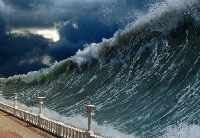
Tsunami Formation: How Earthquakes Play a Role
Not all earthquakes generate tsunamis, but Alaska’s seismic conditions make it a high-risk zone. A tsunami is usually triggered by the vertical displacement of the ocean floor during an underwater quake. This abrupt movement pushes a massive column of water upward, creating waves that can travel at speeds of 500 mph across the ocean.
Interestingly, in deep water, tsunami waves may only appear as a ripple. But as they approach the shore and the water becomes shallower, the wave height increases dramatically, a process known as shoaling.
Factors That Influence Tsunami Generation
For an earthquake to cause a tsunami, several conditions must align:
- Magnitude: Typically 7.0 or higher.
- Depth: Less than 100 kilometers below the surface.
- Location: Must occur underwater or very close to a shoreline.
- Type of Movement: Vertical displacement is required. Strike-slip (horizontal) quakes rarely cause tsunamis.
In this recent Alaska quake, the conditions were alarming enough to activate a full tsunami response protocol.
Geography of Alaska: A Land Shaped by Seismic Forces
Alaska is the largest U.S. state, located in the far northwest of North America. It’s separated from the contiguous 48 states and bordered by the Arctic Ocean (north), the Pacific Ocean (south), the Bering Sea and Russia (west), and Canada (east).
It boasts:
- The longest U.S. coastline
- North America’s tallest peak (Mount Denali)
- Hundreds of islands and active volcanoes
Its physical geography, combined with its position on the Ring of Fire, makes Alaska particularly vulnerable to seismic and volcanic threats.
Video Footage and Public Reaction
Viral clips posted on social media captured the intense shaking in Sand Point—cars bouncing and houses rattling. The footage, though just seconds long, illustrated the powerful force of nature and heightened public awareness.
According to The Guardian, the first tsunami waves were projected to reach Sand Point, home to about 580 residents. Emergency spokesperson Jeremy Zidek emphasized the seriousness of the event, stating, “We’re treating it seriously and making sure communities are notified so they can activate their evacuation procedures.”
Evacuations were also recommended in places like Unalaska and King Cove.
We got this incredible footage of today's earthquake from a resident in Sand Point, about 50 miles from the epicenter. We are grateful to those who shared their experiences — it allows others to understand what an earthquake is like, and be better prepared. We are also grateful… pic.twitter.com/5tkqcbgp9Y
— Alaska Earthquake Center (@AKearthquake) July 17, 2025
How Authorities Respond
The coordination between USGS, NTWC, the Anchorage National Weather Service, and local emergency services showcases Alaska’s preparedness. Despite the tsunami warning being canceled, the rapid alerts, evacuation notices, and constant updates were crucial in preventing panic and ensuring safety.
Alaska: America’s Earthquake Capital
Here are some key stats that underline Alaska’s seismic status:
- 11% of the world’s earthquakes occur in Alaska.
- 17.5% of all U.S. earthquakes happen here.
- The Alaska-Aleutian Megathrust, a 2,500-mile fault line, is the engine behind most of these quakes.
Alaska’s relentless seismic activity means that earthquakes are part of daily life. From minor tremors to major quakes, it’s not a matter of if but when.
Lessons from the Past, Eyes on the Future
Every earthquake in Alaska is a reminder of the 1964 catastrophe. That quake taught hard lessons about building codes, emergency preparedness, and tsunami education.
Today, those lessons save lives. The combination of modern seismic sensors, digital communication, and community readiness has turned Alaska into a model for earthquake response.
Still, vigilance remains essential. With active faults and underwater volcanoes always lurking beneath the surface, Alaska’s residents must stay informed, prepared, and resilient.
The recent 7.3-magnitude earthquake off the coast of Alaska once again put the spotlight on the state’s geological volatility. Thanks to real-time monitoring and a swift response, a potential disaster was averted.
But as history shows, Alaska’s seismic journey is far from over. The key lies in understanding the risks, trusting scientific guidance, and maintaining strong community awareness.
From shaking ground to surging seas, Alaska’s beauty comes with immense natural power—one that its people continue to respect and prepare for daily.
Also Read :
Tomorrowland Tragedy 2025: Main Stage Destroyed by Fire Hours Before Festival Start
Nvidia to Resume H20 AI Chip Sales in China After Trump Administration Greenlight
Bitcoin Sets Impressive New All-Time High at $118K: Should You Buy, Hold, or Sell?
UAE Golden Visa Drama 2025 : Dubai Firm’s Apology Follows Official Clarification